

Countless thousands of Americans this month found themselves racing for cover, fretting about cars and roofs, and covering their ears from the deafening roar of heavy hail. Time and again this spring, and especially during June, a relentlessly locked-in-place weather pattern has driven intense severe thunderstorms from the High Plains across the South and Midwest.
Even far northeast Colorado, which lies squarely in what’s long been nicknamed “Hail Alley”, saw one of its worst bouts of hail on record on Wednesday night, June 28-29.
Hail has a much larger impact on U.S. life beyond scary encounters and freakish photos and videos. Insured losses from hail have skyrocketed in recent decades, topping $10 billion each year since 2008, according to Gallagher Re, a reinsurance firm.
This year’s insured losses from the full range of threats produced by severe weather – what meteorologists and insurers often refer to as “severe convective storms” – are already on a path to exceed $30 billion, according to Steve Bowen, chief science officer at Gallagher Re. By year’s end, insured losses could end up challenging the two top inflation-adjusted years in the Gallagher Re record: 2020 ($44 billion) and 2011 ($40 billion). Across the past decade, U.S. losses from severe weather add up to a phenomenal total of more than $250 billion; in most years, 60% to 80% of that comes from hail.
“If there ever was a year to highlight how little respect hail gets as a significant damage cost driver, 2023 is certainly it,” Bowen said.

And then came June…
“I do think it’s been a particularly active spring season for hail,” said Matt Kumjian, an associate professor of meteorology and hail expert at Pennsylvania State University. “Given that major population centers in the south and southeast were under the gun, it will be no surprise to see large damage costs come from those regions.”
Many folks had been anticipating a rough early spring, given the accurately predicted transition from La Niña to El Niño conditions. Several of the few scientists who attempt to forecast seasonal patterns in severe weather correctly pegged March and April of this year as a high-risk period for supercell thunderstorms, the ones that typically produce the most destructive tornadoes and hail.
According to NOAA’s archive of billion-dollar disasters, the nation’s two costliest severe weather outbreaks so far this year were on March 2-3 from Texas to Ohio ($1.9 billion in damage and 23 deaths) and on March 31–April 1 across much of the central and eastern U.S. ($4.3 billion in damage and 33 deaths). Five other less-costly disasters pushed the year’s total cost to date from billion-dollar events to $18.6 billion through early May.
“Tornado and hail risk are a clear example of how a constant drumbeat of smaller events can produce losses that are on par with a big hazard like a hurricane, even if they tend to attract less attention,” noted Kelly Hereid, director of catastrophe research and development for Liberty Mutual.
Read: Hailstorms and climate change: what to expect
What wasn’t obvious in early spring was how contorted North American weather patterns would become by late May and June. An intense upper-level high stoked drought and record heat across southern Canada, which led to massive early wildfires from Alberta to Nova Scotia and immense episodes of smoke affecting tens of millions of Americans – and even Spaniards early this week, as one plume made its way across the Atlantic to the Iberian Peninsula. (For the record, Kumjian is skeptical that the smoke has had any major influence on the recent spate of hailstorms: “There really isn’t much convincing evidence that added aerosol like smoke would play any sort of role in significantly modulating hail production in supercell storms.”)
The counterpart to the strong upper high in Canada has been persistent upper-level low pressure across the Midwestern and Eastern U.S., giving some areas their coolest and driest late spring in years.
Arcing around the recurrent upper lows has been a branch of the subtropical jet stream from the Southern Plains across the Deep South. Day after day, storms rode this upper-level flow from Colorado to Texas and eastward to Georgia, spawning tornadoes and dumping massive amounts of hail. Other storms developed later in June toward the Midwest and Northeast.
The cold northwest upper flow has paired with very warm, humid air flowing from the southeast at low levels to ramp up both instability and wind shear. “We got into an upper-level flow regime that provides the right shear orientation for hail growth,” said Ian Giammanco, lead research meteorologist at the Insurance Institute for Home and Business Safety. “Combine the flow regime like we’ve seen with typical June instability, and it is a recipe for big hail, especially when you can maintain a discrete supercell.”
Among the standout episodes over the last several weeks:
- Hail up to softball size (4 inches in diameter) hammered areas near Hot Springs, Arkansas, on June 14, leading to what one local fire chief called some of the county’s worst and most widespread hail damage in over 40 years. One hailstone with a 5-inch-plus diameter was reported at Brooksville, Mississippi.
- Thousands of concertgoers at the famed open-air Red Rocks amphitheater west of Denver were pelted by hail as large as tennis balls (2.5 inches) on June 21. Nearly 100 people were treated by paramedics and medical personnel, according to the Denver Post, and seven were taken to the hospital with injuries including broken bones. For longtime residents, the event brought to mind the Elitch Gardens amusement park incident on July 11, 1990, when patrons were trapped on rides during a severe hailstorm and concurrent power outage, leading to 48 injuries.
- Multiple storms during June dropped giant hailstones across parts of West Texas, including one on June 23 that pummeled the Lubbock area with grapefruit-size hail (4.5 inches).
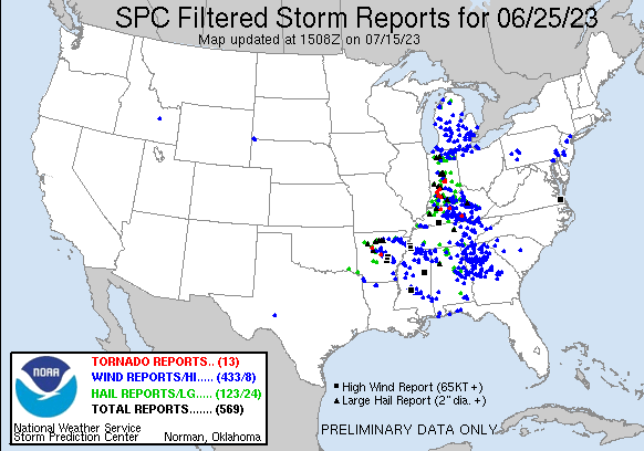
- Supercells dropped hail up to softball size across parts of Indiana and Kentucky up to grapefruit size in Arkansas on June 25. More than 120 instances of severe hail were reported nationwide.
- A 5.2-megawatt solar farm, capable of generating enough power for roughly a thousand homes, suffered major damage after an intense hailstorm with high winds pummeled the Scottsbluff, Nebraska, area on June 23.
Hail’s tremendous toll
The damaged solar farm above prompted much online chortling about the weaknesses of renewable energy projects. Yet the same line of severe storms produced a tornado earlier in the day over northeast Wyoming that struck the North Antelope Rochelle Mine – the world’s largest coal mine – injuring six people and hindering production for an indefinite period.
Hail is an equal-opportunity destroyer, and that destruction has increased by leaps and bounds in recent years across the United States. As noted in Gallagher Re’s Natural Catastrophe Report for the first quarter of 2023, which produced record-high Q1 U.S. losses from severe convective storms (SCS):
The re/insurance industry has been grappling with escalating US SCS losses for nearly two decades….While the more frequent nature of SCS events often leads to insurers seeing most impacts felt in their quarterly earnings reports, the peril is being viewed in a fundamentally different way today as expanding population centers in known active SCS areas are causing a re-evaluation of how to properly view and write the risk.
Read: Climate change and tornadoes: any connection?
As we’ve covered in our Climate Explained posts on tornadoes and hailstorms, the effects of climate change on severe local storms are more subtle and more difficult to separate from natural variability than for phenomena like rising temperatures and more extreme rainfall. Some studies hint that supercells may shift toward favoring larger hail versus smaller hail over time. A recent modeling analysis implies that supercells could increase in number by a few percent by later this century, and there have already been clear eastward shifts in U.S. tornado occurrence. Overall, though, Hereid calls the hail-related links to climate change “among the weakest and a bit of a mixed bag,” at least for now.
“What is clearly changing is where people live and how they build, with clear impacts on increased losses,” Hereid said. Some of the nation’s most hail-prone locations, such as the Denver and Dallas-Fort Worth metro areas, are also among the fastest-growing. And new cars and new houses alike are getting ever-larger, putting ever-vaster swaths of shingles, metal, and glass at risk.
“If a neighborhood was a farm 30 years ago, and today is a built-up subdivision, we see hail losses appear that might not have even been recorded when the local population was lower,” said Hereid. Moreover, “as more homeowners put solar panels on their rooftops, there is suddenly a new set of expensive equipment that wasn’t up there before. So if you’re planning to install solar panels that you expect to last 25 years, but your area gets major hailstorms every 5 years, it’s worth choosing a product that is rated to handle hail impacts.”
The quest for more data on hail and its damaging footprint
Thus far, none of the many hailstones this year classified as “giant” (those at least baseball size, or 2.75 inches in diameter) have set any state or national records for size. Giammanco and colleagues at IHBS recently concluded their annual round of field research, analyzing the impact of hailstones as they strike using instruments called disdrometers. One disdrometer deployed near Happy, Texas on June 11 (see storm photo at top) measured 585 hail impacts across its one-square-foot plate.

The IBHS group also retrieves large hailstones and analyzes them in three dimensions, as they recently did for a gigantic hailstone that fell on June 12 in Mansfield, Texas. That spiky stone measured 5.23 inches in diameter – a hefty chunk of hail to be sure, but still well short of the state-record hailstone from Hondo, Texas, on April 28, 2021, which measured 6.42”. The Mansfield stone’s volume was 21.34 cubic inches, compared to 40.24 inches for the Hondo stone.

As always, a destructive severe weather season can be a bountiful one for severe weather research. Kumjian and fellow Penn State faculty member Kelly Lombardo (see Figure 2) were among the experts who participated in this year’s IHBS field work.
“I’m super excited about the data we collected in the field this year,” said Kumjian. “I’m looking forward to digging deeper to see what the data can tell us about the storms and the hailstones themselves.”
Jeff Masters contributed to this post. Website visitors can comment on “Eye on the Storm” posts (see comments policy below). Sign up to receive notices of new postings here.